
Whether your work background is being a police officer, EMT, teacher, small business owner, or corporate employee — we serve Jaffrey and Rindge, NH residents with Medicare Insurance and retirement planning.
Whether you are in your 40’s or in your 60’s we can help with your retirement planning and education about retirement.
Located in the heart of the Monadnock Region, Tom Villeneuve serves the Jaffrey / Rindge area in addition to other areas in the region.
For a free first-time consult contact Tom at 603-491-4092
Learn more about how I can help you:

Sign-up for one of my free weekly webinars on Medicare and Social Security.
Serving residents who are currently working as police, teachers, EMTs, small business owners, and corporate employees in Jaffrey and Rindge, NH.
about Jaffrey, NH
Jaffrey, NH was first granted by the Massachusetts General Court in 1736 to soldiers from Rowley, Massachusetts, returning from the war in Canada, the town was known as Rowley-Canada. In 1749, the town was re-chartered by the Mason proprietors as Monadnock No. 2, sometimes called Middle Monadnock or Middletown. It was one of the first towns established following the Masonian proprietors' purchase of undivided lands under the claim.
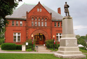
Settled about 1758, the town was regranted in 1767. It would be incorporated in 1773 by Governor John Wentworth, and named for George Jaffrey, member of a wealthy Portsmouth family. Jaffrey's son was a life trustee of Dartmouth College, and designer of the official college seal. The Contoocook River provided water power for mills.
Geography

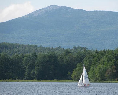
Thorndike Pond is in the north, and Contoocook Lake is on the southern boundary. Mount Monadnock, elevation 3,165 feet (965 m) above sea level and the highest point in Jaffrey, is in the northwest. Jaffrey lies mostly within the Merrimack River watershed, via the Contoocook River in the eastern part of the town, with the northwest corner of town lying in the Ashuelot River watershed, part of the larger Connecticut River watershed.
Source: Wikipedia, Jaffrey, NH
About Rindge, NH

Rindge, NH is a town in Cheshire County, New Hampshire, United States. The population was 6,014 at the 2010 census. Rindge is home to Franklin Pierce University, the Cathedral of the Pines, and part of Annett State Forest.

Geography
The Contoocook River flows north to the Merrimack River, thence to the Gulf of Maine, and the North Branch of the Millers River flows southwest to the Connecticut River, thence to Long Island Sound. Rindge's highest point is on its eastern border, on the lower slopes of Pratt Mountain, where the elevation reaches 1,505 feet (459 m) above sea level.
Rindge is home to the villages of Rindge Center, East Rindge, Converseville, and West Rindge. The town is crossed by U.S. Route 202 and New Hampshire Route 119.
Source: Wikipedia, Rindge, NH